HIKING THE RUBY MOUNTAINS PART 3


HIKING THE RUBY MOUNTAINS (PART 3)
OUTFITTERS, PACK TRIPS AND BACKPACKING GUIDE SERVICE
LINKS TO ASSOCIATED PAGES:
View Photo Preview Page (1) || View Photo Preview Page (2) || Part 1 Trail to Liberty Pass and Beyond
Part 2 Other Wilderness Areas, Photos and Information ||
Part 2 Supplement Other Wilderness Areas, Photos and Information
Part 3 Supplement Outfitters, Pack Trips, Thomas Canyon, Right Fork Canyon and Ruby Valley
Part 4 Hiking the Ruby Crest Trail with Lynda Mellows and Rosanne Baker || Photo Page Hole in the Mountain--East Humboldts
Part 5 Birdeye Lake, Overland Lake, Lake Peak, Smith Lake, Clover Valley and Cave Creek || Part 6 Hiking Difficulty Comparison Chart
Part 7 C-47 and B-17 Military Aircraft Crash in the East Humboldt Mountain Range
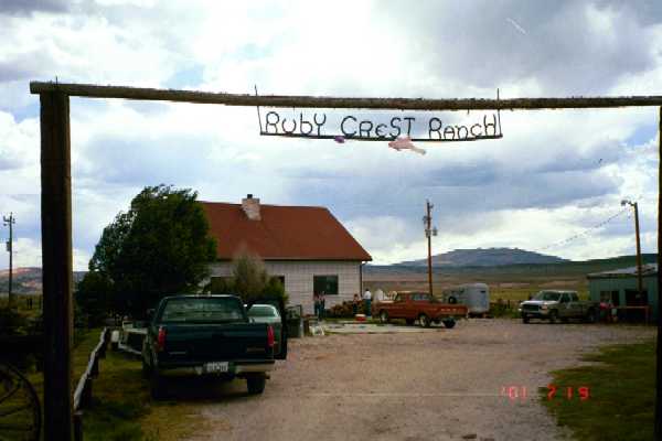
HIDDEN LAKE OUTFITTERS, RUBY VALLEY (Henry Krenka)
HIDDEN, ROBINSON AND SOLDIER LAKE GROUP (from Ruby Valley)
Part 2 and Part 2 Supplement present the most common and direct way of reaching the Soldier Basin area from the west side of the range through Soldier Canyon from Lamoille Valley. A pack trip with Hidden Lake Outfitters goes up the east side of the range in Ruby Valley starting from the Krenka Creek trailhead.
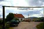
Hidden Lake Outfitters is reached by driving over Secret Pass off I-80 from Elko. Descending from Secret Pass towards Ruby and Clover valleys, watch for the junction to the North Ruby Valley road on the left side of the Secret Pass road. Continue on the Secret Pass road about two miles past the North Ruby Valley junction to a sign on the left which identifies the entrance to Hidden Lake Outfitters.
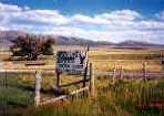
© Hidden Lake Outfitters
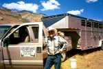
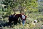
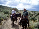
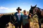 © Outfitter Henry Krenka and Daughter Brandy
There is an access road to the Krenka Creek trailhead directly across the Secret Pass--Ruby Valley road from the ranch entrance. This is a public access road that crosses about three cattle guards (no gates to open) and continues for a mile or so through the sagebrush into the foothills. A 2-WD vehicle can make it most or all the way up to the trailhead.
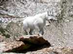
The initial destination is the high ridge and saddle directly in front. The terrain is steep but the trail is easy to follow and makes numerous switchbacks through mostly open country to the ridge. This is a good deer spotting area but Bighorn Sheep and Mountain Goats are scarce. The next destination is the main trail in Soldier Basin but upon scaling the ridge, there is one canyon to cross before dropping down into the basin.

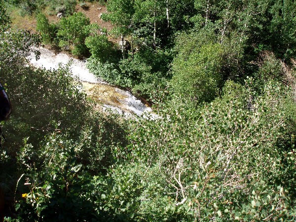
© Trail Break
The trail will join the main Soldier Basin trail at a sign indicating Ruby Valley (where you started from) if you were going the other direction. Continue to the left on this trail to Soldier, Hidden and Robinson lakes. Hidden Lakes should be your primary destination. The trail crosses Soldier Creek from left to right, makes a short but steep climb, and the trail to Hidden Lakes branches off to the right about 100 yards after the creek crossing. This is not as distinct a trail as the main trail.
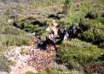
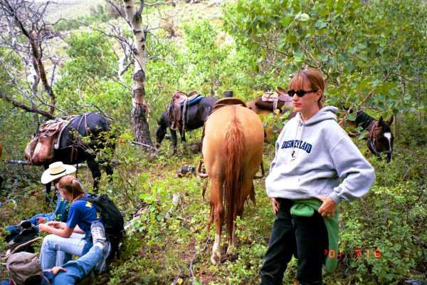
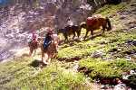
© Horses at Creek Crossing
The Hidden Lakes trail begins to the right just a short distance beyond this creek crossing.
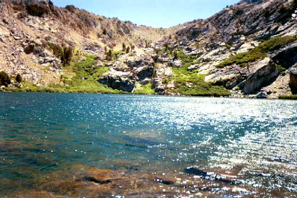
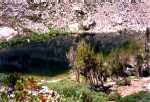
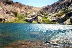
The trail gains some altitude and a half-mile or so later Hidden Lakes will be found beneath the cliffs. The larger of the two lakes, on the right when facing the cliffs, is the best fishing lake of the two. During a recent trip, two fisherman were at the lakes and had caught about ten or twelve Cutthroats the past two days.
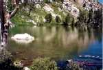
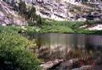
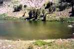
© Upper Hidden Lake

© Lower Hidden Lake
The trail from Hidden Lakes continues around the side of the mountain and skirts the far end of Robinson Lake which has some swampy areas (and maybe some cattle). Try wading out to the rock a few feet from shore for some fishing. This lake is shallow at about six feet or so and fishing for Brook trout should be good.
© Robinson Lake
© Cliffs Above Robinson Lake
Cold Lakes are on the other side of the cliffs in the above right photo.
The Soldier Lake group can be checked out on the way back down the canyon as the main trail will pass by this group of ponds and one or two small lakes.
Return to top of Page (or scroll to next section)
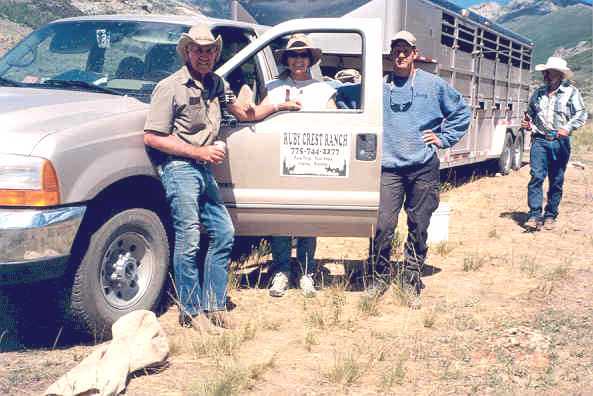
NEVADA HIGH DESERT OUTFITTERS (Mitch Buzzetti)
COLD LAKES
Nevada High Desert Outfitters is located at the Ruby Dome ranch off to the right of the Lamoille Canyon road a half mile before actually entering the canyon. The ranch is identified by a large sign extending over the gate (usually locked).
© Chad Alexander

© Jaime Henriod
Guide Chad Alexander and helper Jaime Henriod when, under the name Nevada High Country Outfitters, was operated by Todd Schwandt, now retired.
Nevada High Dessert Outfitters goes to Cold and Verdi lakes, and further north to Greys and Winchell lakes. Trail description and locating the access road to the Cold Lakes trailhead from Lamoille Valley is described in Part 2, Other Wilderness Areas.

© Unloading the Horses

© Lakes Beyond the High Peak
 © Trail Scenery
 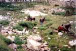 © Leading Horses up Rocky Trail
The final 150 yards of trail before the lake are steep and rocky and the horses must be led up this section of trail.
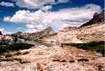
© Upper Cold Lake

© Lower Cold Lake
© Cliffs Above Lakes
© Cliffs Above Lakes
This is a potentially good area for spotting Bighorn Sheep and Mountain Goats but they weren't out on this particular day. Ruby Valley is on the far side of the ridge in the left photo.

© Jeannie, Jaime, Buddy & Horses

© Looking for a Victim
© Upper Cold Lake
© Lower Cold Lake
Robinson Lake lies over the ridge in the right photo. Robinson Lake can be accessed by climbing to the saddle on the left side of the high peak in the center of the photo.

© Michael & Horse--If the Hat Fits, Wear It
Return to top of Page (or scroll to next section)
HIDDEN LAKE OUTFITTERS, RUBY VALLEY (Henry Krenka)
ADDITIONAL HIDDEN, ROBINSON AND SOLDIER LAKE PHOTOS (access from Soldier Canyon)
Hidden Lake Outfitters has been identified above. The Hidden Lakes group can be accessed from either side of the mountain range.

© Steepled Church at Crossroads in Lamoille

© Soldier Canyon Parking Area

© Soldier Creek Crossing
The parking area in Soldier Canyon will accommodate about a dozen vehicles; or fewer if horse trailers are included. Wade Soldier Creek to start the hike or ride up Soldier Canyon. At one time you could drive across the creek, although somewhat steep on the far side, but one or two large boulders in the creek bed now prevents vehicle crossing. However, the road continuing on the other side doesn’t go more than a quarter mile and parking space is lacking. Follow the road until it merges with the trail in the canyon, almost completely enclosed by aspens.

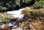
© Soldier Creek in Canyon
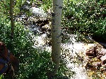
Soldier Creek down the steep canyon is narrow and fast running and potentially dangerous. Less than 20 feet off the trail in places, if you have a dog along, keep him away from the creek. An animal caught in the creek would have a very difficult time getting out.

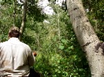
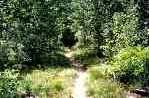
© Narrow and Dense Trail Through Canyon
Much of the narrow two mile trail through the canyon is in the shade which results in pleasant hiking. The bad news is the rocky and boulder strewn trail throughout the entire length. There may also be springs creating muddy conditions across the trail.

© Entering Soldier Basin from the Canyon
© Krenka Creek Trail Sign from Ruby Valley
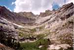
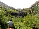
Breaking out of the canyon into the basin, the terrain almost flattens out and, lacking the rocks, the trail improves considerably. The basin lacks trees, including tall aspens, and is not a particularly scenic area, especially later in the season when the shrubbery starts to turn brown. The photos in this section were taken during July when the hillsides were still an attractive blanket of green.

© Creek Crossing in the Basin
A short distance into the basin, the trail will cross Soldier Creek from left to right. The trail then ascends a steep but short hill and if your immediate destination is Hidden Lakes, try to identify a narrow and less distinct trail leading off to the right of the main trail some 200 yards past the creek crossing. If the trail cannot be identified, just angle off the main trail at about a 45 degree angle towards the cliffs off to the left. Brush and other shrubbery is low and hiking off trail is not difficult.
© Side View of First Soldier Pond
© End View Soldier Pond
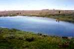
Continuing up the main trail, the trail will first lead to the Soldier Lake group. It is sometimes stated that this group consists of six or seven lakes but more accurately it is six or seven ponds, with only one or two large enough deserving of lake status. The pond shown above, the second largest, is the most scenic but is only inches deep.

© Largest Soldier Pond

© Sign to Hidden Lakes near Soldier Ponds
Continuing over the next low ridge, the largest Soldier pond as well as three or four very small ones will come into view. The Soldier Lake group is not known for fishing (but possibly the largest one could contain a few Brook trout). From this area you can cut off the main trail at about a 90 degree angle towards Hidden Lakes.
© Robinson Lake

© End View Robinson Lake
Robinson Lake will finally come into view after crossing another low ridge or two. Robinson Lake is fairly large but shallow, located on a flat area lacking trees and good scenic quality, but usually provides good fishing for Brook trout. Robinson Lake is completely surrounded by a perimeter of marshy area. In the above left photo, Hidden Lakes are located over the lower ridge near the upper right corner of the photo.

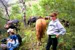
© Trail Break and Lunch near Robinson Lake: Mitch Buzzetti, Mike, Erin and Cindy
From Robinson, the trail will continue around the left end of the lake and along the base of the mountain to the very scenic Hidden Lakes, the primary and ultimate destination of the Soldier Canyon trip. Hidden Lakes contain large Cutthroat trout but fishing will probably be slow.
© Upper Hidden Lake

© Lower Hidden Lake

© Heading Back Towards the Canyon; Soldier Peak in Background
Return to top of Page (or scroll to next section)
ELKO GUIDE SERVICE (RUBY CREST RANCH) (Bill Gibson)
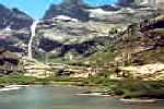
OVERLAND LAKE
Ruby Crest Ranch is located near the South Fork Reservoir. Take the Lamoille Highway, SR 227, from Elko to the junction of SR 228 at Spring Creek. Turn right at the stop light and continue for 5.5 miles to the turnoff to the South Fork Recreation Area. Turn right for about two miles to Hamilton Stage Road and again turn right. The road will connect with Meadow View Drive. Merge left on Meadow View until the road makes another right turn on Hamilton Stage Road. Proceed to the ranch on the left.

© Bill Gibson, Outfitter, and Kristy Wright, Trail Guide
Elko Guide Service makes trips over the entire Ruby Crest Trail, and to Echo, Lost and Overland lakes.
© Ruby Crest Ranch

© Cabin at the Base of Gennette Canyon
The cabin is the starting point for the pack trip to Overland Lake from the west side of the range. Gennette Canyon is some distance from the ranch near the South Fork Recreation Area, and riders spend the night at the cabin for an early start the next morning.
© Bill Gibson

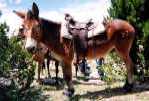
© Horses at Corral near Cabin
The trail starts as a gentle sloping trail through sagebrush and some aspens as it works its way towards a distant high ridge. The trail eventually joins the Ruby Crest Trail and switchbacks take over as the terrain becomes steeper when approaching the saddle on the ridge. Upon crossing the divide, the terrain on the east side is steep and rocky and the ride is not as leisurely as it had been on the west side.

© Ascending and Descending the Steep and Rocky Trail out of Overland Lake

© Classic View of Pond Above Overland Lake

© Overland Lake

© Cabin at Lake
© Another View of the Lake
The cabin in the photo was constructed by the CCC's (Civilian Conservation Corps) during the '30s. Do not use the cabin since it is occupied by bats, mice and other rodents and the viral concentration would be quite high.

© Overland Lake through Trees
© Candice with Horse
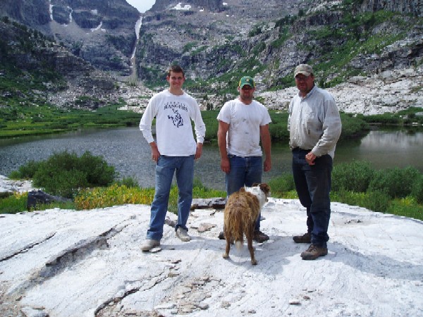
 © George, Deb, Dave and Bill
The only reason we do these things is for the beer at the end.
 © Theo and Tux
Nevada ranch kittens brought in from the cold. Theo was rather friendly and wasn't too hard to catch but Tux didn't want anything to do with anybody. But after some concerted effort we were able to keep him off some coyote's dinner menu.
Additional Overland Lake photos and information can be found at Part 2, Other Wilderness Areas, Photos and Information and Part 5, Birdeye Lake, Overland Lake, Lake Peak, Smith Lake, Clover Valley and Cave Creek.
Return to top of Page (or scroll to next section)
HUMBOLDT OUTFITTERS (Mike Morrison)
BOULDER/STEELE LAKES
Humboldt Outfitters, prior to retirement of Wilde Brough, had been located in Clover Valley below Steele Lake in the East Humboldt range. To locate Wilde's ranch, drive to Wells on I-80 from Elko and take Route 93 south from Wells to SR 232. SR 232 continues south along the base of the mountains. Look for a mailbox with the name on the left side of the Clover Valley Road.
Mike Morrison's ranch is located a short distance out of Wells.
Humboldt Outfitters primarily takes in Boulder and Steele lakes but might also go to Greys and Winchell lakes in the Angel Lake area as trade-off destinations with another outfitter.

© Humboldt Outfitters Master Guide "Big Mike" Morrison
With Marc and Matt Morrison
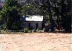
The meet location will not be at the Outfitters' ranches for all trips. However, if you were going to Steele Lake with Mike Morrison, the meeting place would still be near Wilde Brough's ranch (since Steele Lake is directly above the ranch). However, if going to Boulder Lake, accessed from the opposite side of the range, the meeting place would probably be the Starr Valley Convention Center. From Elko, drive east about 30 miles on I-80 to the turnoff to Deeth. A mile or so down this road, a sign will indicate Deeth to the left but keep going straight. The Convention Center is a small white building on the left side of the road five miles from the I-80 turnoff. The front door of the building faces the road.
There is a turnoff to the right at the Convention Center and this road will continue south along the base of the mountains through Starr Valley. The starting point for the trip, a few miles down this road, is from a ranch located adjacent to the road and more or less between 3rd and 4th Boulder Creek canyons. Starting from there, the trip to Boulder is nine miles one way. The old route, when you could drive some distance up 3rd Boulder, was about seven miles.

© Deb & Candice
© Mule Wondering if we are About There Yet
There were about as many mules on the above trip as there were horses, and the mules seemed to adjust better to the rigors of the improvised trail. Completing the round trip in a single day, whether by foot or on horse, you will definitely know at the end that you have been somewhere.
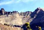
© Hole in the Mountain Basin from Starr Valley
 © Hole in the Mountain from Clover Valley Basin
Photo furnished by Doug Clarke, U.S. Forest Service, Elko. The location was reached by a long hike starting from Lizzie's Basin trailhead in Clover Valley.
The window is about 30 feet in diameter.
The trail starts in the sagebrush and proceeds up the ridge between the two canyons. Hole in the Mountain Peak is visible near the skyline of a distant ridge. The window, around 30 feet in diameter, can be clearly seen but it is too far away to be impressive. Some distance later 3rd Boulder Creek Canyon will be immediately off to the right. The horses will pick their own trail down the rather steep descent into the canyon. At that point a road continues for a short distance and the going is easy for a ways. The former hiking trail following the creek at the bottom of the canyon is completely overgrown and cannot be used.

© Ridge Above 3rd Boulder Canyon

© Trail Break
 © Cindy Wondering if we are About There Yet
After the road comes to an end, the trail continues along the left side of the canyon and, losing itself in places, makes its way through open terrain, sagebrush, mud, boulders and aspens. There is hardly any question as to why this area was named "The Boulders". Occasionally the aspens are so thick that it is difficult for the pack horse with its wide pack saddles to make its way through.
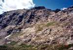
Traveling slowly up the canyon, terrific scenery takes over with steep and high granite cliffs imposing themselves along the sides of the canyon. Now is the time to start testing your Deer, Bighorn Sheep and Mountain Goat spotting abilities. Nothing beats going in by horse for taking in the scenery. When hiking there is the tendency to be looking down at the trail much of the time to keep from stumbling over rocks, snags and fallen trees, and you miss the deer and other wildlife darting out ahead.

© Cliffs Along Trail

© View Towards Ridge Above Boulder Lake
The canyon makes a sweeping turn to the left and you can see the ridge up ahead that separates Boulder and Steele lakes. The distance slowly closes in and finally you get the satisfaction of being one of relatively few people who have ever seen Boulder Lake. One of the first things to do is to climb to the ridge directly in back of the lake and view Steele Lake on the other side. Climb down to the lake if inclined but have a good look at the terrain first. This is Mountain Goat territory.
© Boulder Lake from Near Side

© Boulder Lake from Far Side
Upon one arrival, a Forest Service helicopter was engaged in wildlife counting and it chased 25-30 Bighorn Sheep for about a half-mile around the upper basin. We were down at the lake at the time and could not get suitable photos. We climbed to the ridge a short time later and came almost face to face with four Mountain Goats. I was unable to photograph the closest one, less than six feet away, but three others came by and I was able to get digital photos of those.

© Mountain Goats on Ridge Between Boulder and Steele Lakes
We were there during mid-day and attempts at fishing were unsuccessful. However, the lake continues to sustain large Brook trout. Brian Harasha of Spring Creek had been to the lake on an overnight trip about a week earlier, and, fishing during the early morning and evening, reported that they caught the biggest Brook trout that he had ever seen. He reported that trail conditions were poor, and that hiking in over the Secret-Starr trail took 15 hours of actual hiking over two days to reach the lake.

© Boulder Lake

© Steele Lake
Return to top of Page (or scroll to next section)
SECRET PASS OUTFITTERS (Walt Gardner)
BOULDER/OVERLAND LAKES
Walt Gardner of Secret Pass Outfitters in Ruby Valley can be contacted at telephone number 775-779-2201.
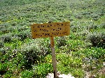
Secret Pass Outfitters makes trips to Boulder and Overland lakes. The trailhead sign shown below is a public access route to Overland Lake and Secret Pass Outfitters uses this route to the lake.
To locate the trailhead sign, drive to Harrison Pass on SR 228 from Spring Creek, a distance of 33 miles from the Spring Creek junction. Drive 11 miles over the pass to the Ruby Valley road and turn left. Nine miles later look for the Rock House off to the left side of the road. A short distance later, after crossing a cattle guard, look for the trailhead sign off to the left side of the Ruby Valley road.
© Rock House

© Trailhead Sign to Overland Lake
 © Start of Overland Lake Trail
Drive up the trail access road as far as possible to eliminate some hiking distance.
Link to Part 5 of this site Birdeye Lake, Overland Lake, Lake Peak, Smith Lake, Clover Valley and Cave Creek
for photos and detailed trip information to Overland Lake with Secret Pass Outfitters. Also included in this same section is trip information into the Boulders area to Birdeye Lake through Pole Canyon with Secret Pass Outfitters.
Return to top of Page (or scroll to next section)
ELKO GUIDE SERVICE, Bill Gibson)
SEITZ LAKE
 © Seitz Lake
A horse trip to Seitz Lake, when Outfitter service to the lake again becomes available (not available as of july 2010 and earlier), would likely start out from the area of the Ruby Dome Ranch, just off the road leading into Lamoille Canyon, thereby eliminating the difficult start of a hiking trip from the shooting range. However, even by horse, and considering that the one way distance is only around three miles, this is a rough horse trip because of the disintegrating trail conditions.
Trail Starts out in the Sagebrush
But Soon Enters the Aspen Thicket with Fading Trail
 Cliffs Along the Way

Skirting a Beaver Pond
Approaching First Shelf

Descending Rocky Portion of Trail
Return to top of Page (or scroll to next section)
Return to top of Page (or scroll to next section)
BACKPACKING GUIDE SERVICE (Allen Tatomer)
Allen Tatomer specializes in conducting guided backpacking trips in the Lamoille Canyon area and makes at least two trips per season. He is a Lamoille native currently residing in Northern California, and founded the Bay Area based California Adventure Club and Family Trekkers hiking groups. Most Ruby Mountain trips are run under the auspicies of the "Ruby Alpinists", a specialty group of the California Adventure Club.
He has been conducting an Early Season trip in June, and then a Fall Colors trip in early October. The trips include a one or two night campover at the Thomas Canyon campgrounds, camp breakfast provided, and then several days overnight backpacking into the mountains to various locations depending on conditions. Participants will receive an honorary Ruby Alpinists membership and certificate after completion of their first trip.
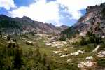
Tatomer has a good knowledge of the mountains and most of their more popular canyons, and has been able to give all participants a unique hiking/backpacking adventure. Trips are noted for reconoitering off-trail jaunts, visiting some breathtaking snow covered passes and ridges, visiting unnamed lakes complete with peak bagging, great fishing, and evening star gazing, all at a generally relaxed pace. His built in flexiblity can allow an off day on longer trips, giving participants the choice to laze around the high camp and do what they wish. Favorite destinations include upper Thomas Canyon cirque, upper Right Fork meadows and/or cirque, upper Island Lake cirque to Full House Peak, and upper Lamoille Canyon to Snow Lake and Mt. Fitzgerald Peak.

© South Face of Mt. Fitzgerald

© Upper Thomas Canyon from Mt. Fitzgerald
 © Mt. Fitzgerald Base Camp
Photos by Allen Tatomer from the Mt. Fitzgerald area, a popular hiking destination, located towards the end of Thomas Canyon.
The trips are open to early teens and older; the only requirement being the ability to carry ones own backpack and gear. Allen has attracted a wide variety of conditioned hikers ranging from borderline conditioned car campers to accomplished climbers. He has had clients from New Jersey to California that includes some from Las Vegas, Redding and Portland. Average trip size is about eight participants, but will be limited to no more than 25. Fees, if any, vary from $40 to $100 depending on the hiking activities, entertainment and number of participants. A visit to one of the great Basque restaurants in Elko for evening dinner is usually on the agenda.
© Small lake at upper Right Fork Canyon (nicknamed Goat Lake)
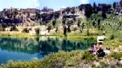
Photo by Allen Tatomer during July 2001
Allen is a member of the Sierra Club and the California/Nevada Desert Committee, and he holds a certification in Wilderness First Aid by the American Health and Safety Association. All trip participants are required to sign a liability waiver in lieu of insurance.

© Allen (or is it Moses) somewhere in the Rubies
The 2008 9th Annual Ruby Mountains Rendevous is scheduled for June 28th through July 1st, 2008, which includes special musical entertainment by Sherryl Eve during the evening of Sunday, June 29th. Hiking usually takes in the Thomas Canyon area and to Lamoille and Island lakes. A Basque feast at Elko is often scheduled and cooking duties at the campsite are shared.
Email Allen Tatomer or call 925-439-0434 (fax 925-432-1022) for reservations, fees and additional information. Note that this is an excellent and convenient way for first time visitors to become familiar with the Lamoille Canyon area.
For more information on past trips, visit www.climber.org. and search on authors, Allen Tatomer.
Return to top of Page (or scroll to next section)
JIGGS AND HARRISON PASS PHOTOS

© Old Jiggs School House
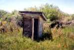
© Outdoor Plumbing
Jiggs is located on the way to Harrison Pass on SR 228 about 26.5 miles from the Spring Creek junction of SR 227 and SR 228. At the ages of three and four, the web author spent twenty below zero winters at the Jiggs School House.
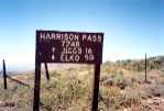
© Harrison Pass Summit

© Ruby Crest Trail Sign
Depending on your hiking direction, the Ruby Crest Trail signpost identifies either the beginning or end of the trail. When starting from Harrison Pass, drive up the trail access road as far as you can. The road continues for about four miles.
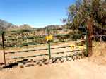
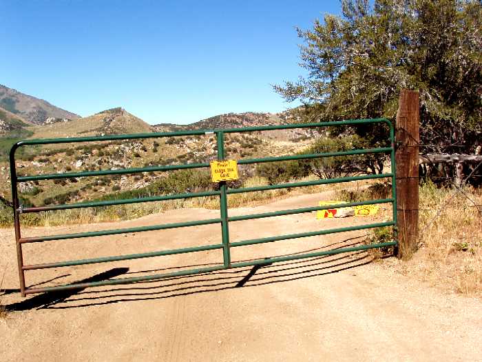
Unlocked Gate a Mile or so up the Trail Access Road

Continuation of Road Beyond Gate


© Star Tungsten Mine Cabins Located Adjacent to Harrison Pass Road
Working for $1 per day Government pay during the '30s, the CCC employees used the cabins when working in the Harrison Pass and Ruby Valley areas. They constructed many of the trails in the mountains.
Return to top of Page (or scroll to next section)
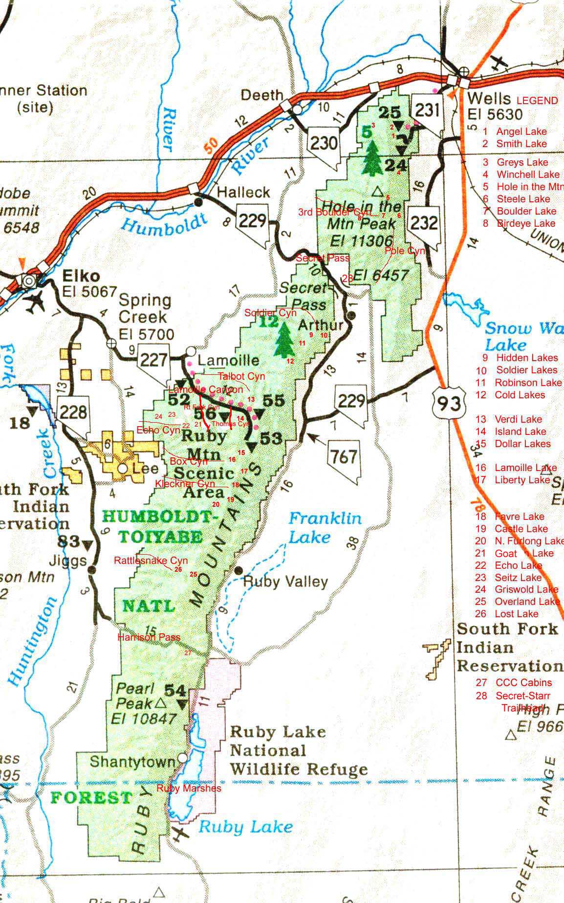
AREA MAP
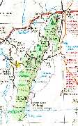
Map Displaying Lake Locations and Other Geographic Features
Click the map image to expand to full size (file size is 279k so loading time may be slow). The map will show the locations of many features mentioned on these pages. Included are the communities of Elko, Wells, Deeth, Jiggs, Lee, Lamoille and Spring Creek. Some geographic features shown are Ruby Valley, Secret Pass, Harrison Pass, the Ruby Marshes (Ruby Lake National Wildlife Refuge), and Lamoille Canyon. Relative positions are shown for all named lakes in the Ruby Mountains and East Humboldts as well as some other major canyons. To prevent over-crowding, the distances apart are not exactly to scale.
CAMPGROUNDS AND PICNIC AREAS
LAMOILLE CANYON AND ANGEL LAKE
Two designated campgrounds are available, one at Thomas Canyon off Lamoille Canyon in the Ruby Mountain range and the other at Angel Lake in the East Humboldt range.
The Thomas Canyon Campground is located on the right side of the Lamoille Canyon road eight miles from the canyon entrance. It is generally open May through September but this can change with the weather. There are about 42 campsites that are fairly secluded due to a heavy concentration of aspen and cottonwood trees. The campsites generally have fire rings and running water is available along with quite good "outdoor accommodations".
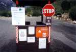
© Campground Entrance
© Registration Information
The peak season is June through August and if you want to camp in the canyon, it is advisable to make reservations to ensure a campsite. Reservations must be made at least four days ahead of time and can be made up to eight months in advance. The reservation period extends to September 1st, and after that it is first-come, first-served. Call 1-877-444-6777 for reservations. The daily rate is normally $14 and payment arrangements are made at the time of the call. Note that the office for reservations is located in Texas so they cannot provide any local information. To inquire about snow or other conditions in the Ruby Mountains, call the U.S. Forest Service office at 1-775-752-3357. Large motor homes would be out of place in the campground, and camps usually consist of tents, pickups with camper shells, or small camper vehicles.
Upon your arrival at the campgrounds, check in with the campground's host who usually resides in a trailer to the left upon entering the campground. If you are arriving cold without reservations, contact the host for available campsites.
The Angel Lake campground is located at Angel Lake, a twelve mile drive on SR 231 from the town of Wells. Wells is located 50 miles east of Elko on I-80. There are about 26 sites at the campground and it is not quite as formalized as the Thomas Canyon campground. Reservations can be made from five to 120 days in advance by calling the National Recreation Reservations Services at 1-800-280-2267 or the 1-877-444-6777 number as shown above for Thomas Canyon. Fees are $14 per night and most campsites can accommodate two vehicles.
An on-site host is usually available at campsite 26. If a site is unoccupied, you can use the site but you may have to move later if it is reserved. Due to the winding road and steep climb to Angel Lake, large RV's are not recommended. The road to Angel Lake is normally open around the end of May during the Memorial Day weekend and campsites are available at that time. The campgound hosts are usually there the first of June. The U.S. Forest Service office at Wells can be called at 1-775-752-3357 for road and snow conditions.
There is another campground called the Angel Creek Campground located at the base of the mountain right before starting up the steep grade to Angel Lake. The most recent available fee for this campground is shown as $12 per night. This campground would be preferable to driving a large motorhome up to Angel Lake and reservations can be made through the same reservation number, 1-877-444-6777.

© Angel Lake Recreation Area

© Angel Lake
The "No Overnight Camping" refers to a temporary condition.
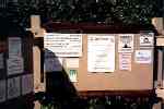
Lamoille Canyon has two picknicking areas that are not to be used for overnight camping. The Powerhouse Picnic area is located at the mouth of the canyon and an exit road to the right off the Lamoille Canyon road leads into the area. This site can remain open for some time into the late fall and winter before the road might be closed due to snow.

© Powerhouse Picnic Area
© Registration Information
The sign warns of the possibility of rattlesnakes. This is the most likely area in the canyon where they might be seen.
© Lamoille Creek Through Picnic Area
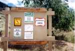
The Terraces picknicking area is located on the left side of the Lamoille Canyon road about 10.5 miles from the mouth of the canyon, and this area would close around the first or second snowfall of the season.

© Terraces Picnic Area

© Entrance to Terraces
The daily rate at the picnic areas is $4 on the honor system. Both areas have good accommodations and they are usually not crowded.
Return to top of Page (or scroll to next section)
HANGING VALLEY NATURE TRAIL
There is an easy hike, or walk, mostly through aspens on the Nature Trail located on the right side of the Lamoille Canyon road a mile or so past the Thomas Canyon campground. Look for the Nature Trail sign but it could be hidden by cars parked along side the road. In this case, park where you see the other cars. If you come to the Terraces picnic area you have gone a half mile too far.

© Hanging Valley, Start of the Nature Trail
 © Nature Trail Through Aspens
  © Beaver Dam and Pond
The trail makes a one-quarter mile loop through aspens and cottonwoods and passes by some beaver dam activity that resulted in some realignment of Lamoille Creek. These dams and burrows are more impressive early in the season, June or July, when there is more water flowing in the creek and the beaver ponds are deeper. There is hardly any rise or fall in elevation along the easily traveled trail.

© Beaver Pond

© Lamoille Creek Above Dam
Return to top of Page (or scroll to next section)
Email correspondence to Ruby Mountains Express
I respond to all emails
George Sheaks
Ventura, CA
(Elko native)
Search This Site With: www.atomz.com to Identify Pages that Contain Subject Matter of Interest.
Use of the "Exact Phrase" option is usually recommended in order to avoid most non-relevant hits. Set Within: to 'Anywhere' in order to also include text captions on photos. Hits on the search terms will provide links to the page(s) where the text is located along with text summaries. The summaries should help identify the pages with the desired information.
The search engine identifies exact text (or almost exact text) and not concepts. For example, to find photos of North Furlong Lake (or anything else), do not search for 'photos of North Furlong Lake'. Instead, search for 'North Furlong Lake' which will identify pages containing that text and most or all identified pages will usually have the related photos.
Return to top of Page
Part 1, Trail to Liberty Pass and Beyond
Part 2, Other Wilderness Areas
Part 2 Supplement, Other Wilderness Areas, Photos and Information
Part 3 Supplement, Outfitters, Pack Trips, Thomas Canyon, Right Fork Canyon and Ruby Valley
Part 4, Hiking the Ruby Crest Trail with Lynda Mellows and Rosanne Baker
Part 5, Birdeye Lake, Overland Lake, Lake Peak, Smith Lake, Clover Valley and Cave Creek
Part 6, Hiking Difficulty Comparison Chart
Part 7, C-47 and B-17 Military Aircraft Crash in the East Humboldt Mountain Range