HIKING THE RUBY MOUNTAINS PART 2


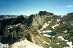
ANGEL LAKE GROUP
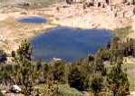
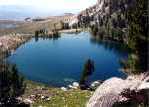
Angel Lake is located at the extreme north end of the East Humboldt section of the range, and is the only lake in the entire range you can drive to. Because of the drive, Angel Lake is a popular picknicking area. Drive to Wells, 50 miles east of Elko, and then take the 12 mile drive up to Angel Lake. As unlikely as it may seem, due to easy and frequent access, fishing at Angel Lake can be good. The lake has Brook and Tiger trout and may also contain Rainbow.
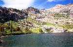
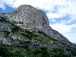
© Angel Lake

© Angel Lake from Greys Lake Trail
WINCHELL, SMITH & GREYS LAKES
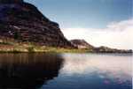
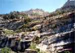
Other lakes accessible from the Angel Lake area are Winchell, Greys and Smith, and these lakes do not get much attention.

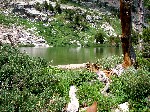
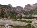
© Greys Lake

Greys Lake is about a ten mile round trip from the trailhead at Angel Lake. Greys Lake is shallow at only about six feet in depth and contains Cutthroat trout. Winchell is about a six mile round trip from its trailhead which begins about two miles back down the road from Angel Lake. Winchell is not noted as a fishing lake but the trailhead sign does show a fish (meaning fish in the lake).
Greys Lake can also be reached by a shorter and easier route from the Starr Valley side. Link to Part 3 Supplement for additional Greys Lake information.
Smith Lake can be reached by an off-trail climb that is short but challenging. Start out on the Greys Lake trail from Angel Lake and at less than one mile you will come to an East Humboldt Wilderness sign.
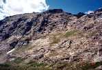
 © Greys Lake Trailhead
  © East Humboldt Wilderness Sign
The trail then bends to the left and will start to go downhill. There is a saddle below the ridgeline in front of you as the trail turns left and this is your destination. Smith Lake lies just beyond the saddle. Immediately leave the trail to the left rather than follow the trail down.

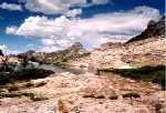
© Smith Lake is just Beyond the Saddle
After leaving the trail, try to stay as high as you can for as long as you can until the terrain seems suitable enough to start working your way down and then upwards towards the saddle. Any route you choose will take you over or around high boulders, through high, dense brush and snags, and up through loose footing for a half mile or so. It is not the least bit easy.
However, it is not necessary to take this mostly off-trail and difficult route to Smith. For the easy way to the lake taking less than an hour which, along with Winchell and Island lakes, now qualifies as one of the easiest lakes to get to, link to Hiking the Ruby Mountains Part 5. Smith Lake is high on the list of the most scenic lakes in the entire mountain range.
A 2003 fishing report confirms that the lake does contain Cutthroat trout that are up to 15 inches in length. Golden trout were supposed to have been planted but their survival is unknown.
None of the lake trips should be considered real easy but some are easier than others. Along with Island Lake, the hike to Winchell Lake is one of those that is easier than others and is a delightful hike. As you are driving towards Angel Lake, locate the trailhead sign on the left side of the road near a 90 degree turn to the right about two miles from Angel Lake. Parking is on the opposite side of the road from the sign. The sign indicates four miles to the lake but it is closer to three.
The hike to Winchell is different since instead of hiking up a canyon you are traversing the side of the mountain. It's like a walking roller coaster ride as you traverse one vertical ridge after another and the shallow canyons in between. The overall elevation gain is less than 1000 feet but you will repeat some of the gained and lost altitude over the successive uphill and downhill portions of the trail. This means that overall you may climb 1600 feet but lose 700 feet during the process for a net gain of 900 feet.

© Beaver Ponds

© Happy Camper
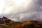 © Storm Clouds
 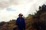 © Wet and Disgruntled Camper
What started as a cool, overcast and comfortable hiking day ended with thunder, lightning, rain and hail, and dipping temperatures.
Constantly traversing the canyons and ridges may get a little disconcerting after a while as you start to wonder where the lake is. There is a tendency to think that the lake just has to be in a basin up one of the canyons that you have been passing for the last hour or so. Eventually you will see a low horizontal saddle below the ridgeline and the lake is just beyond the saddle. The trail makes a short climb and you are there.

© Chimney Rock
The trail passes some distance below Chimney Rock on the way to Winchell Lake.
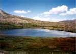
The trailhead sign to Winchell indicates fish in the lake but the Lakes of the Ruby Mountains Ranger District chart indicates that there aren't any. This is a rather small lake, not very deep, and the winter freeze could very well prohibit any fish life.
© Winchell Lake
Link to: Additional Winchell Lake trail and lake photos.
Return to top of page (or scroll to next section)
BOULDER/STEELE LAKES
(An Unfortunate Dilemma)
Due to fish quality, I consider Boulder and Steele lakes to be the best fishing lakes in the entire range, but you need to be there very early in the morning or in the evening. The first fish you catch from either lake will amply reward your hike. The Brook trout in both lakes are well fed, much fatter than usual, and heavy for their eleven or twelve inch length. It's like catching Clydesdales after catching Quarter Horses in other lakes. However, it is no longer easy to get to Boulder (but it is now a little easier to get to Steele).
Boulder and Steele lakes are in the East Humboldt Range. The west side of the range is Starr Valley and the east side is Clover Valley. There is a small valley area called Secret Valley on the east side of Secret Pass, and Secret, Ruby and Clover valleys converge at this point.
Boulder Lake located on the Starr Valley side of the range is at the end of Third Boulder Creek Canyon. Before the crossing of private property became a problem in certain areas, you could drive right up to the trailhead at the entrance to Third Boulder Creek Canyon and begin the pleasant and gradual seven mile hike to the lake. Things have now changed. When you locate and attempt to drive up the road to Third Boulder Creek Canyon, you will be met by a locked gate with a "No Trespassing" sign.
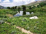
BOULDER LAKE
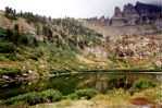
© Boulder Lake and Pond
The last time that the Forest Service and other agencies attempted to obtain an easement agreement into Third Boulder was in 1996. There didn't seem to be any overwhelming reason why the easement could not be obtained other, perhaps, than someone might leave a gate open.
However, there are still at least five ways to get to Boulder Lake but none are easy. From Starr Valley you can still reach the lake from Third Boulder Canyon by starting from the Starr Valley road near the base of Fourth Boulder Canyon. There is a ranch adjacent to the road where you should ask permission to park your car and start the hike. The beginning of the trail is a two wheel-track road just a few yards north of the ranch which will take you to the ridge separating Fourth and Third Boulder Creek canyons.
This route is a nine mile one way trip, mostly by an uncharted trail maintained only by horse traffic a few times each summer. After accessing the ridge, look towards the skyline on the left where Hole in the Mountain will be visible in the distance. After proceeding along the ridge for a ways, drop down a steep hill into Third Boulder Canyon to the right. A road will continue for a short distance, but the former easy hiking trail up Third Boulder Creek no longer exists and the horse trail, such as it is, proceeds for the most part along the left side of the canyon. This is an arduous trip, even by horse. The canyon eventually makes a sweeping turn to the left and at that point the ridge, still quite some distance away, can be seen that separates Boulder and Steele lakes.
A second way is from the Secret-Starr trailhead. This is a shorter straight line distance but not necessarily an easier route since you have to cross First and Second Boulder canyons by an equally unmaintained trail and then drop down into Third Boulder. Michael White describes this route in his book "Hiking and Backpacking Guide". To locate the Secret-Starr trailhead, drive to Secret Pass from I-80 out of Elko. Descending into Secret Valley from Secret Pass, almost to Ruby and Clover valleys, look for the Secret-Starr trailhead sign on the left side of the Secret Pass road. The sign is about 100 feet off the road and a dirt road leads up to the trailhead sign. If you come to the junction of the North Ruby Valley road, you have gone a little too far.

© Secret-Starr Trailhead Sign
Another way is up Pole Canyon from Clover Valley which is not too distant from the Secret-Starr trailhead route, but, unlike the Secret-Starr trail, this is not a public access route. The entrance to Pole Canyon is from the North Ruby Valley road, through a locked gate, and then continuing up the road leading into Pole Canyon. This road crosses private property and it is not known if permission could be obtained to gain access. This is the route used by Secret Pass Outfitters into the Boulders area and inquiry could be made with them at 775-779-2201 to find out if it would be possible to gain access through the gate.
The road extends into the canyon area about three miles and the hiking distance into Boulder Lake is then about six miles. Again you would cross First and Second Boulder canyons and drop down into Third Boulder. The route is maintained by horse traffic and is a better way than going in by the Secret-Starr trail.
Week's Creek Canyon from Clover Valley has been described as another way into Boulder. Hiking up Week's Canyon does not appear to be that difficult but it would end with a steep climb to a ridge and then a descent to the lake. Week's Creek Canyon is one canyon removed to the north of the Steele Lake basin. Steele Lake is located directly above Humboldt Outfitters on the Clover Valley road. See Part 5 of this site Birdeye Lake, Lake Peak, Smith Lake, Clover Valley and Cave Creek for information on locating Week's Creek Canyon and the road leading into the area.
Finally, you could climb to Steele Lake from Humboldt Outfitters in Clover Valley and then climb over the ridge behind Steele Lake and descend to Boulder. The climb to the ridge above Steele Lake is loose and steep and very demanding. The climb to this same ridge from the Boulder Lake side is more gradual and not as difficult. After reaching Steele Lake and taking a look at the ridge ahead, you may be satisfied not to go any farther.
It's difficult to suggest a recommended route. The choices are either long and bushwacking or steep and bushwacking. Everything considered however, the best way is to go in by horse. Link to OUTFITTERS section for information and consider Secret Pass or possibly Nevada High Country Outfitters for a day or overnight trip to the lake. To fish the lake, it must be an overnight trip. Humboldt Outfitters goes in from the Starr Valley side while Secret Pass Outfitters and Nevada High Country Outfitters will go in by way of Pole Canyon.
© Boulder Lake and Boulders
© Boulder Lake from the Far Side
On one trip to Boulder, when you could hike directly up Third Boulder Canyon, we left Elko at 4:00 p.m. and had exactly five hours of daylight left to drive to the trailhead by way of Deeth and make the seven mile hike to the lake. We would have to make good time up the trail so to cut down on weight we each took a light blanket rather than a sleeping bag. We made it to the lake in time but the small amount of firewood that we found during the waning minutes of daylight was consumed in an hour.
A breeze started coming in from across the lake and by midnight the temperature dropped to near freezing. A Levy jacket and a light blanket weren't nearly up to the task. We were awake all night shivering violently and huddled in front of the large rock in the above photo on the left. Excellent fishing come daybreak made up for the very uncomfortable night.
STEELE LAKE
The good news is that it is now easier to reach Steele Lake which will lessen the desire or necessity to go to Boulder. Steele has always been a somewhat better fishing lake than Boulder anyway. Previously, to reach Steele, you either had to climb over the ridge and back from Boulder (difficult and not something to look forward to), or do a bushwhacking climb through the sagebrush up a steep ridge from Clover Valley.

Arrowhead Shaped Steele Lake from Ridge Separating Boulder and Steels lakes
Starting from Humboldt Outfitters in Clover Valley, a trail has now been constructed that leads about half way up to Steele Lake. To use the trail, drive to the Humboldt Outfitters ranch and ask for directions. They take horses up this trail, but with a trail half way up the mountain, the overall hike/climb to the lake would be much less strenuous than it was previously.
To drive to Clover Valley from Elko, consult a Nevada highway map of the area (or the Forest Service map) and first drive to Wells on I-80 and then take route 93 south to route 232 which proceeds along Clover Valley at the base of the mountains.

© Mountain Goats Above Boulder Lake
We had climbed to the ridge between Boulder and Steele lakes, and, not knowing who surprised whom the most, a mountain goat came around a rock less than six feet away. I had a film camera in hand trying to reload a roll of film and could not get a shot. The goat took two or three hops and disappeared down the steep slope towards Steele Lake.
Retrieving a digital camera, two more goats came by 20 feet away and posed for photographs. An hour earlier 25-30 Bighorn Sheep passed by this same spot but we were down low at the time, and trying to photograph the sheep at this distance was unsuccessful. This was a spectacular sight as the sheep ran for a half mile around the entire upper basin surrounding Boulder Lake. They were being chased by a Forest Service helicopter engaged in wildlife counting.
Return to top of page (or scroll to next section)
ROBINSON/SOLDIER/HIDDEN LAKES GROUP
Robinson, Soldier and Hidden lakes are a well known group of lakes located in
Soldier Basin in the Ruby Mountain section of the range, but the area rates a very distant second in popularity behind the Lamoille Canyon area. The primary attractions are the two very scenic Hidden Lakes. Robinson Lake and the Soldier Lake group, the latter consisting of five or six small ponds, lie in a flat area, almost devoid of trees, and lack the scenic quality of Hidden Lakes.
These lakes can be reached from either the Lamoille Valley side of the range or from the opposite Ruby Valley side. The most popular and well know access is from Lamoille Valley due to shorter driving distance from Elko.
The trailhead at Lamoille Valley is reached from either the community of Lamoille or the Halleck area. See Part 2 Supplement Directions to Soldier Canyon Trailhead from Lamoille for additional trail information and route information through Lamoille.
The trailhead is reached by driving two miles up Soldier Canyon on a one lane dirt and dusty road. Soldier Canyon is completely different than Lamoille Canyon and so are the trails completely different. This would be a fairly easy 10 mile round trip if it were not for a certain mile or two of fairly steep, rocky and rugged trail through the canyon before coming to the basin. The narrowness of the canyon prevents any switchbacks along the trail. The trail then breaks out of the canyon into an open area and continues into Soldier Basin where the hiking is easy. The trail will pass a Ruby Valley trail sign on the left. This is the trail leading up from the Krenka Creek trailhead in Ruby Valley.

© Soldier Creek Within the Canyon
 © Soldier Creek in Soldier Basin
  © Soldier Peak in Background
The first lake you would come to by following the trail is the Soldier Lake group followed by Robinson Lake. From either location you can then make your way off trail towards the cliffs on the right to Hidden Lakes. However, to take the most direct route to Hidden Lakes, bypassing Soldier and Robinson, a short distance after entering the basin from the canyon the trail will cross Soldier Creek from left to right and the trail will make a steep but short climb to the top of a small hill. About 100 yards later, start looking for a narrow and less distinct trail leading off at an angle to the right. If this trail cannot be identified, just angle your way off trail to the granite cliffs where Hidden Lakes are located. These are two lakes separated by a narrow strip of land. The lakes contain some large Cutthroat trout up to 18" in length that are usually difficult to catch.
© Lower Hidden Lake
© Upper Hidden Lake
Both Hidden lakes are at the same elevation but the reference to the "lower" lake is the one farthest away from the mountain. This lake is the larger of the two, located to the right when facing the lakes, and is the primary fishing lake of the two. The largest of the Soldier ponds is visible in the background of the above left photo.
Robinson Lake is not visible from Hidden Lakes but a trail will continue down and around to Robinson Lake. Robinson Lake is located on a flat area just over the divide between Lamoille Valley and Ruby Valley. This flat location would tend to explain why the lake is so shallow (six feet or so). Warm springs may seep into the shallow lake to keep it from freezing solid in the winter.
© Robinson Lake

© Robinson Lake
Wade out to the rock several feet from the shore to try some fishing. Fishing for Brook trout at Robinson Lake is generally reported to be good but can be windy much of the time which can account for poor results. It is not likely that any of the Soldier ponds contain fish.
© The More Scenic Soldier Pond

© Largest Soldier Pond
The Soldier ponds are shallow and are more appropriately measured in inches rather than feet.
Link to Robinson Lake Photo, for an unusual early morning photo of the lake by Larry Hyslop of Elko.
For more Soldier Canyon hiking information and lake photos, go to: additional Soldier Basin and lake photos.
Return to top of page (or scroll to next section)
VERDI LAKE
Verdi Lake is a little known lake in Talbot Canyon that parallels Lamoille Canyon to the north of Lamoille Canyon. I was not particularly successful during the one time I tried to fish the lake but it is reported that fishing for fairly large Cutthroat can be good. The big challenge here is just getting to the lake.
There are two ways to access the lake: hike up Talbot Canyon, about an eight mile one way trip beginning near the community of Lamoille, or by scaling the ridge from Lamoille Canyon. Looking for a way up to the ridge from Lamoille Canyon, a gullywasher that had washed out the road had left a nice chute down the side of the canyon that seemed to be in the right location and not too difficult to traverse. The chute, now more prevalent than ever, is on the left side of the road while traveling up the Canyon and about a mile or so past the Thomas Canyon campgrounds. Following the chute to the ridge resulted in a perfect view of the lake on the far side.
The successful climb up the chute and the descent to the lake was through steep and rocky terrain with the usual loose footing. Since then the gully has gone through more gullywashers and avalanches resulting in much more rock exposure that includes small, medium and hugh loose bolders and large expanses of sheer rock, making ascent and descent more difficult.
© Verdi Lake

© Photos Taken from Climb Towards Verdi Ridge
The photo on the left was taken from the Lamoille Canyon road. The sheer rock face near the bottom is the start of the climb.
However, some climbers start the climb to the ridge from The Terraces, a picnic area a little farther up the canyon, and climb to the vicinity of Verdi Peak overlooking the lake. There is supposed to be somewhat of a game trail via this route but we were unsuccessful on two occasions trying to find the trail.

© Cave Above Terraces
© Cliffs Above Terraces
Link to: Part 3 Supplement for information on accessing Verdi Lake from Talbot Canyon.
VERDI RIDGE MYSTERY
Scaling the ridge by the chute route described above, there is a brass plate embedded in a rock on top of the ridge that appears to be a memorial to someone. I don't recall the inscription, which is rather brief, but it is entirely possible that someone could take a fatal fall down the side of Lamoille or Talbot canyon. Another Web author who has seen the brass plate put it this way: "...like someone was playing on the ridge and fell off."
Return to top of page (or scroll to next section)
OVERLAND LAKE
Overland Lake is a popular lake off by itself in the southern section of the Ruby Mountains range, and can be reached from each of the four major points on the compass. The lake is a major destination point when traversing the Ruby Crest Trail and upon so doing, the lake can be approached from either the north or the south. The lake can be reached from the west side of the Ruby range through Gennette Creek Canyon but this would normally be a horse trip with Elko Guide Service (Bill Gibson) since this route goes through private property. Finally, it is most commonly reached by a trail from the steeper east side of Ruby Valley which is a general access route. Secret Pass Outfitters uses this route to the lake.
From Elko, turn right onto SR228 at Spring Creek and drive over Harrison Pass to Ruby Valley. The distance from the SR228 junction to the start of Harrison Pass is 33 miles. Descending into Ruby Valley 11 miles later, turn north, or left, onto the Ruby Valley road. For years this road was rough, dusty, washboaded dirt and gravel but now has been improved to oiled gravel or asphalt.
Nine miles later, look for the Rock House about 40 yards off to the left side of the road. The Rock House had been a bar and later a Post Office but is currently vacant. It is now fenced in with a blank white sign in front.
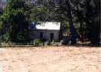
© Rock House
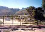
Continue about three-quarters of a mile farther and upon approaching a cattle guard, look for the Overland Lake trailhead sign on the fence about 25 yards to the left of the cattle guard. The trailhead sign indicates eight miles to Overland Lake but it is closer to six miles. Michael White in his Nevada Wilderness Areas and Great Basin National Park, A Hiking and Backpacking Guide, even has it at five miles. It probably is closer to five but due to difficult hiking conditions, there is no doubt a tendency to exaggerate the distance. Turn left on the trail access road, which continues for about a quarter mile into the foothills, and drive up the road as far as you can to eliminate some dry and dusty hiking distance.

© Overland Lake Trailhead Sign
The trail to Overland is well defined but otherwise can only be described as hot, dry, dusty, difficult and with no shade and no water along the way. Not considering the entire Ruby Crest trail due to its length, this trail to Overland is one of the most difficult routes to any destination that has a trail over the entire distance. Other destinations are more difficult but only because some or all of the route is off trail. Based on my 1 to 7 (easy to difficult) trail ranking scheme (see Part 6 of this site Hiking Difficulty Comparison Chart), this route is rated at 5.5.
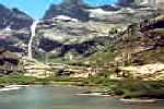
The trail traverses three canyons, gaining altitude with each canyon, before reaching the lake and there are more switchbacks than will be encountered on any other trail of the same or lesser length. Upon reaching the third section of switchbacks, Overland Lake creek canyon can be seen some distance to the north but the trail does not descend into the canyon. You are about at the lake when the Overland Lake trail merges with the Ruby Crest trail. A log cabin is next to the lake but occupancy is not recommended unless you want to share it with rodents that call the cabin home.
Fishing for Brook trout is usually good but they are usually small.

© Overland Lake
Additional Overland Lake photos and information can be found at Part 3, Outfitters, Pack Trips and Backpacking Guide Service and Part 5, Birdeye Lake, Overland Lake, Lake Peak, Smith Lake, Clover Valley and Cave Creek.
LAKE MARIAN
There are references to Overland Lake having been called Lake Marian (or Lake Marion), but these names are not generally recognized. However, the U.S. Board of Geographic Names USGS Geographic Names Office does list Lake Marian and Lake Marion as variant names and Overland Lake as the official name.
For some interesting history as to how this came about, visit web site Gilbert Munger's Paintings of Lake Marian which relates to Clarence King, a geologist who later became the head of the U.S. Geological Survey, and had visited Overland Lake during 1868 and named the lake after his sister Marian as a Christmas present.
It is not known when Overland Lake became the official name of the lake and King may have named a previously named lake. But on the other hand, probably not. Nearby Elko did not start coming into being until 1869, a year after King had coined the Lake Marian name, and it seems very unlikely that any of the Ruby Mountain lakes would have acquired their current, official names before Elko became Elko. So it appears that the Lake Marian name just faded into obscurity and King lost out on his original naming efforts.
Artist Gilbert Munger joined King's survey party during 1869, the year after King had named the lake, and had traveled with King to California. While there he painted Donner Lake in the Sierra Nevada range. It is thought that Munger may have accompanied King on a return trip to Lake Marian/Overland Lake during 1869 or after, and if so, would have been in a position to paint the lake while there. On the other hand, there may be some speculation that Munger may have painted the Lake Marian pictures from the black and white photograph that was taken by expedition photographer Timothy O'Sullivan (see the Gilbert Munger web site for this photo and Munger's paintings).
To add some additional confusion, the inscription "Donna Lake" along with the year 1872 appears on the back of one of Munger's Lake Marian paintings. To try to explain the Donna Lake inscription, the best guess seems to be that Munger applied this inscription a few years later and had confused the lake name with that of Donner Lake in the Sierras (that he had painted), perhaps thinking that Lake Marian was Donner Lake. However, there is no doubt whatsoever that the Lake Marian/Donna Lake paintings in the Gilbert Munger web site are in fact Overland Lake.
To summarize, although it appears that the Overland Lake name came along later, the official and recognized name is Overland, but the Lake Marian and Lake Marion names are listed as variant names. "Donna Lake" has to refer to Donner Lake in the Sierras.
Return to top of page (or scroll to next section)
ECHO LAKE
Echo Lake is a remote lake that sees few visitors, and, as a result, fishing Echo for Brook trout and possibly even a Mackinaw Lake trout is about as good as you will find. There are at least four very difficult off-trail routes into Echo Lake that can generally be described as via Seitz Canyon, Right Fork Canyon, Box Canyon from Lamoille Lake, and Box Canyon skirting Kleckner Canyon from Liberty Pass. These routes all have one thing in common--the approaches to the lake are on steep cliffs high above the lake which makes it necessary to descend over loose boulders to get down and then back up again when leaving. The recommended way to the lake is by hiking the trail up Echo Canyon which will eliminate this dangerous approach and the arrival will be at lake level.
Echo Canyon is not easily recognizable from the road into Lee since the entrance to the canyon is off to the left and partially hidden by a foothill. The hike is about five to six miles up the left side of the canyon and should be an overnight trip to take advantage of the early morning and evening fishing.

© Echo Lake

© Bighorn Sheep near Echo Lake
© Echo Canyon from the Vicinity of Lee
Accessing Echo Canyon is somewhat inconvenient since Indian reservation land must be crossed that requires paying an access fee for admittance through a locked gate. The fee is normally $25 per person for hiking and fishing but if there are quite a few in the party, the $25 fee might be downward negotiable. The access fee for hunting is $125 per person. Along with Echo Canyon, access to Kleckner Canyon, Long Canyon and Rattlesnake Canyon also requires crossing reservation land.

© Te-Moak Reservation Sign

© Reservation Travel Office
To make arrangements, place a telephone call to the Te-Moak Reservation Travel Office at Lee, tel 775-744-4273, which is open weekdays, 8:00a to 4:00p.
Jennifer Bell is an administrator at the office. Make the arrangements a day or two in advance since you need to arrange for someone to meet you at the travel office and then make the drive to the locked gate. You can then drive an additional four or five miles to the forest service boundary where you start hiking. A four wheel drive vehicle is preferable on any of these two tire track roads leading into the mountains, but usually a high clearance two wheel drive vehicle will do the job. Standard passenger cars should not be attempted.
To locate the Travel Office, drive from Elko on the Lamoille Highway to Spring Creek just over the Lamoille Summit and turn right at the stop light onto Route 228 (which would eventually take you to Harrison Pass). Thirteen miles later, a sign will identify the cutoff to Lee on the left. Drive an additional seven miles (one-half mile passed the end of the paved road) to the Travel Office on the right which is a reddish-brown colored building (shown above).
The route to Echo Lake from Echo Canyon is almost a direct straight line shot up the canyon. After climbing or going around the small foothill at the mouth of the canyon, the trail is gradual with no switchbacks and from almost the very beginning you can see your destination at the end of the canyon. Unlike most other destinations, there are no deceptive canyon bends or hanging valleys along the way that obscure the destination. The distance is about five to six miles. The trail gets little use, but this is still the only practical way to reach Echo Lake on foot.
Part 3 Supplement presents information for making a horse trip to Echo Lake with outfitter Bill Gibson, Elko Guide Service, who uses a different route starting from Lamoille Canyon and going over Liberty Pass.
Return to top of page (or scroll to next section)
GRISWOLD AND SEITZ LAKES
(Another Dilemma)
Seitz and Griswold lakes located in Seitz and Hennen canyons are not the most popular hikes in the range but they do add some diversity. No two canyons are alike so wherever you go you are always encountering something new. The hikes to Seitz and Griswold are about six to seven miles round trip but the trails are no longer maintained by the Forest Service. The reason given for this is that the area is unavailable for general public access (but only to a limited extent as explained in a later paragraph).
The lakes are accessed from the Pleasant Valley area that is located at the base of the mountains and just south of the road leading into Lamoille Canyon. The direct route to Seitz canyon used to be from a road skirting the base of the mountains that branched off the road leading into Lamoille Canyon. The Ruby Dome ranch now occupies this area and although the road still branches off the Lamoille road, it passes through a private gate into the ranch and the road is not available for public access.
However, entrance to Seitz and Hennen canyons is controlled by the Spring Creek Association and it only takes $10 per day and a $25 returnable deposit to rent a key for access through a locked gate off Pleasant Valley road.
The Spring Creek Association office is located at 451 Spring Creek Parkway, tel. 775-753-6295, with office hours of 8:00 a.m. to 5:00 p.m., Monday through Friday. Stop in personally a day or so in advance for a key in order to get an early start on the day of the hike. To find Spring Creek Parkway, drive from Elko through the community of Spring Creek on the Lamoille Highway, pass the high school on the left, and continue on the Lamoille Highway to Spring Creek Parkway. This is a fairly busy intersection for the area but does not have a traffic light (as of July 2007). Turn left and proceed for 2.5 miles to the office on the left side of the road. Obtaining a key is only a minor inconvenience.
To reach the locked gate, continue driving on the Lamoille Highway towards Lamoille and watch for the turnoff to Pleasant Valley road on the right (about two miles before the turnoff to Lamoille Canyon). Follow this road three miles to the green locked gate on the left. Unlock the padlock to let yourself through and of course lock the gate after entering.
© Locked Gate to Hennen and Seitz Canyons
Drive a short distance down the dirt road to a fork in the road. The road straight ahead at the fork leads into a rifle range and a 4-WD road to the left of the rifle range leads up the ridge overlooking Seitz Canyon. Park at the top of the ridge, making sure your vehicle is not in the path of a stray bullet, and walk down into the canyon for the start of the hike to Seitz Lake (or start hiking on the road from the area of the rifle range).
The road to the right at the fork will continue for about a mile to the Griswold Lake and Ruby Dome trailhead sign at the base of Hennen Canyon. This is the primary access route for those climbing the Ruby Dome, the highest peak in the Ruby range, via Griswold Lake. Although this trail to the lake is not maintained, it gets enough foot traffic to keep it open and easy to follow. The main trail continues all the way up the left side of the canyon.
While this hike is fairly easy, at least up to a point, the most difficult part comes about a quarter mile from the end where the entire canyon and basin turn into a rock field that cannot be avoided. Considering the expanse and the rock distribution, this is unlike any other rock distributions in these mountains. Imagine a shovel full of sand, one grain on top of another, and then convert each grain to a rock up to one or two feet in diameter, no ground, grass or shubbery in between. Most of the rocks are loose; exercise great case when crossing this rock field.
For a good overhead photo of Griswold Lake, link to Griswold Lake Photo.
For additional Griswold Lake photos and information, link to: Part 2 Supplement.
SEITZ LAKE
© Seitz Lake
Due to the rock field and a few large deadfall Cottonwood and Aspen trees blocking the trail, attempts should not be made to take horses all the way to Griswold Lake but horses can be taken to Seitz Lake. However, there is no comparison between the two trails. The "trail" to Seitz is truly not maintained and probably doesn't see more than half a dozen foot traffic attempts per season. This is a rough three mile trail and can only be described as difficult to very difficult.

© View from Ridge into Seitz Canyon--Descending Into Canyon Not a Pleasant Way to Start Hike
From the ridge above the rifle range, descend through the sagebrush to the bottom of Seitz Canyon. Lacking scenery at this point, there is a two tire track road, from when the road used to go farther up the canyon, that can be followed for a ways. When the road ends, tall and dense aspen growth begins. The initial difficulty now is trying to recognize and follow the trail through the aspens. The next obstacles are two beaver ponds, still with aspens along the edges, that must be crossed. The canyon is narrow and the trail continues along the bottom of the canyon on the left side. If you are making the hike around the end of July of later when the water is low, you can probably keep to high but muddy ground above the ponds. Otherwise sloshing through the ponds, one rather long and deep, will keep your feet cool.

Beaver Pond

Crossover Canyon from Seitz Canyon to Adjoining Canyon
After the ponds and about halfway up the canyon, a mountain pass or crossover canyon will be seen on the right. You are not going there (fortunately) but shortly thereafter the first of two shelves will be encountered that must be climbed. The route to the first shelf is straight up and steep with no switchbacks that is next to the granite wall on the left of the canyon. This section of trail is the steepest of any trail that will be encountered in the Rubies and East Humboldts. A waterfall can be seen near the left side of the shelf. The aspen growths finally give out after reaching the top of this shelf and the scenery is more open with typical rocks, loose footing and dwarf willows.
Huge Rock Formation

First Shelf--Try to Pick Out Waterfall on the Left of the Shelf
The second shelf now looms up ahead. The trail, now more difficult to follow than through the aspen growths, threads its way upward through the loose and rocky terrain with unusually short switchbacks. If you can't follow the switchbacks, just make your own. Eventually the trail will be at the same level as the shelf but the hard parts are not yet over. It's now only a short distance to the lake but to get there more vertical climbing is necessary until you are above the lake and then, finally, a descent and you are there. You will no doubt have it all to yourself. The chute on the far side of the lake is at least partially filled with snow year around. Due to a large flat rock near the lake, a helicopter could actually fly in and land there.

Beaver Pond Back Down the Canyon

Climbing the Second Shelf

Canyon Scenery
First View of Lake

Seitz Lake

Mike and George at Lake
For additional Seitz Lake photos and trail information, link to Seitz Lake sections at: Part 2 Supplement, Other Wilderness Areas and Part 3, Outfitters.
Return to top of page (or scroll to next section)
COLD LAKES
Cold Lakes qualify as two of the most scenic lakes in the mountain range.
These two lakes are on the Lamoille Valley side of the Ruby Mountains range and are located just over the ridge behind Robinson Lake. There is no trail leading over the ridge so you may have to brush up on your mountain goat climbing. Hiking into the Robinson Lake area from either Lamoille Valley or Ruby Valley, climbing over the ridge to Cold Lakes and back, and then out again is probably not something that you would want to try in one day.
Hike to Hidden Lakes for overnight camping (rather than to Robinson), and the next day follow the hillside around to the vicinity of Robinson Lake (off to your left), and pick your way up towards the right side of the ridge behind Robinson. Upon scaling the ridge, Cold Lakes will be in view off to the left. Sidehill down towards the lakes to keep from losing altitude.
Lake access from Lamoille Valley is through private property, and the preferred way to go is by making packtrip arrangements with Nevada High Country Outfitters or Hidden Lake Outfitters. The horse trip can be easily made in one day.
Fishing for Brook trout is excellent in both lakes. Golden trout had been planted in Cold Lakes but they failed to survive. This is a prime area to observe bighorn sheep and mountain goats.
© Ridge Behind Robinson Lake
© Ridge From Cold Lakes
For additional photos and Cold Lakes information, link to Part 3, Outfitters and Pack Trips
Return to top of page (or scroll to next section)
BIRDEYE LAKE
Birdeye Lake is a little known lake near Boulder Lake, does not have any direct trail access, and is the least viewed lake in the East Humboldt range. It is located in the cliffs above 3rd Boulder Creek Canyon on the right as you are approaching Boulder Lake from 3rd Boulder Canyon starting from Starr Valley. It lies on a small shelf about one mile down from Boulder Lake and it may take some guesswork to recognize the shelf. The difficult climb to the lake from the canyon is relatively short but is steep through dense brush.
Michael White mentions Birdeye Lake in his book "A Hiking and Backpacking Guide". For a rare view of probably what is the very first photograph of Birdeye lake, go to Glacial Lake, East Humboldt Mountains which shows a black and white photo taken by photographer Timothy O'Sullivan who was with the Clarence King Survey during the 1860s. The lake name for the photo is shown as Glacial Lake. An O'Sullivan photo of nearby Boulder Lake is shown at Glacial Lake/Upland Lake, East Humboldt Mountains where the name of Boulder Lake is indicated as Glacial Lake and Upland Lake. Neither of those names are currently used. There are some references to the lake name spelling as Birdseye, but the U.S. Board of Geographic Names lists the official name as Birdeye with no variant names. Birdeye is a small lake that does not contain any fish.
For first-hand recent photos of the lake and vicinity with access information via Pole Canyon from the Secret Valley/Clover Valley side of the range, link to Part 5 of this site Birdeye Lake, Lake Peak, Smith Lake, Clover Valley and Cave Creek. Access to the lake from this route is up the steep and rocky ridge that separates 2nd and 3rd Boulder canyons.
Return to top of page (or scroll to next section)
B-17 AND C-47 MILITARY AIRCRAFT CRASH IN THE EAST HUMBOLDTS
During early December 1952, a military C-47 aircraft crashed during a heavy snowstorm about 100 feet below a mountain peak on the Clover Valley side of the East Humboldts. The following summer we thought we would try to locate the crash site which was close to 11,000 foot elevation. The steep 4,000 to 5,000 foot climb from Clover Valley had all the promises of a wild-goose-chase, but surprisingly we did locate the site and walked right up to one of the radial aircraft engines on the hillside.
Starting out, the venture seemed questionnable at best, so I was not in much of a hiking mood and dozed while Kenny drove the 70 miles to Clover Valley. From the Clover Valley road, we drove up the Week's Canyon access road past Lizzie's Basin, and continued as far as we could in a 2WD pickup. While we can't retrace the exact steps, we then hiked some distance farther up the road before angling up the hillside to the right, the south facing slope of Hole in the Mountain Basin. At least it was a nice day so if we didn't find anything, all would not be a complete waste of time.
After climbing through the rocks and sagebrush for some distance, success was starting to look rather iffy but finally, some 300 to 400 more yards up the hillside, an object shining in the sun had to be something other than a rock. We arrived at the object, one of the aircraft's engines, around mid afternoon and Kenny's hunch that we were in the right area became a reality. Sitting on the engine would surely make a great picture. "Did you bring a camera?" "No, didn't you bring one?" Same answer.
For newspaper coverage following the discovery of the C-47 crash site (and the B-17 crash site that follows) and the recovery of the downed flyers, link to Aircraft Crash Information--Newspaper Articles.
Hole in the Mountain Basin is north of Boulder and Steele lakes and access information to Week's Canyon and Lizzie's Basin can be found at Part 5 of this site, Birdeye Lake, Lake Peak, Smith Lake, Clover Valley and Cave Creek.
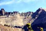
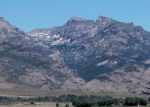
© Hole in the Mountain (distant photo)
Photo furnished by Humboldt Outfitters guide Mike Morrison.
 © Hole in the Mountain (close photo)
Photo furnished by Doug Clarke, U.S. Forest Service, Elko. The location was reached by a long hike starting from Lizzie's Basin trailhead in Clover Valley.
The window is about 30 feet in diameter.
There was a second plane crash in the same general area of the East Humboldt mountain range that occurred during January 1943. This was a Boeing B-17 Flying Fortress flying out of Wendover Field, Utah. The crash site is against a peak just south of Humboldt Peak on the east side of the range, just over the ridge from where Pole Canyon and 1st Boulder Creek Canyon merge from the west. Unofficially the crash is presumed to have occurred during a heavy snowstorm with low visability, but weather reports reflected only scattered snow showers and pilot and co-pilot were to alternate flying under the hood during the mission. The downed plane was not located until the following summer.
This crash site is south of Boulder and Steele lakes and the two crash sites are about four to five miles apart. Access to the B-17 site is by a long trek up Pole Canyon that starts from the Secret Valley area near the east side of the range. Walt Gardner of Secret Pass Outfitters goes into this area. The Norden bomb sight was recovered from the B-17 but some wreckage from both planes still remains on the hillsides.
For newspaper coverage following the discovery of the B-17 crash site (and the above C-47 crash site) and the recovery of the downed flyers, link to Aircraft Crash Information--Newspaper Articles.
Return to top of Page (or scroll to next section)
FU-GO INCENDIARY AND EXPLOSIVE DEVICES
One of the best kept secrets of WW II is the bombing of North America by the Japanese. Called the Fu-Go (balloon bomb) program, this bombing was not by aircraft but by paper balloons, about 33 feet in diameter, carrying incendiary devices and anti-personnel type explosives. About 9,300 balloons were launched that were to have been carried across the ocean on the jet stream. Ballast was periodically dropped along the way to keep the balloons aloft, and an onboard battery lit a fuse to release the bombs at the time they should have been over North America. Another device was to destroy the balloon to evade detection but this device rarely worked.
Sources estimate that only about 1,000 of the balloons actually made it to North America, and only about 300 have been discovered. Unexploded balloons were found in several western and mid-western states and two were found around the Elko area.
Unfortunately, the balloons were responsible for six fatalities in Oregon, caused from the explosion when an attempt was made to drag a balloon with the bomb attached, but otherwise very little damage was done. Hoping to create panic by starting forest fires, the bombs and incendiaries were dropped during the winter with little effect. The Fu-Gos were kept quiet by the media, were not known to the general public, and only reports of failures got back to the Japanese. Consequently, the program was discontinued after about seven months.
So, there could possibly be a few undiscovered and yet unexploded bombs waiting to be found. The balloon casings, however, having been constructed of paper material, would probably be disintegrated by now. Finding one of the bombs while hiking in the mountains would be a unique discovery, but could be a potentially deadly souvenir.
Additional Fu-Go information can be found at Fu-Go, The Strangest Weapon of World War II
Return to top of Page (or scroll to next section)
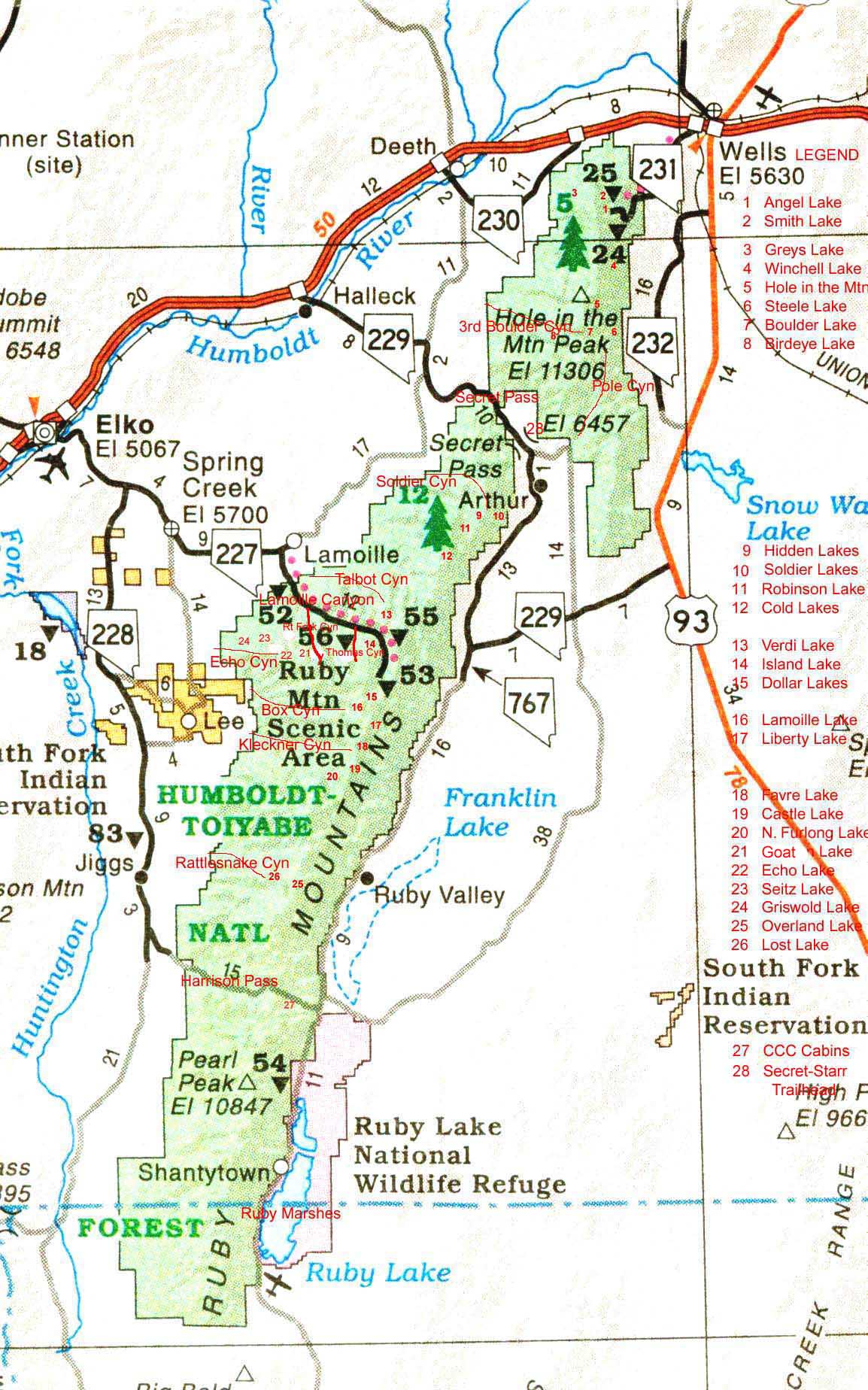
AREA MAP
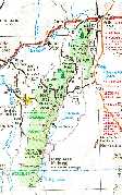
Map Displaying Lake Locations and Other Geographic Features
Click the map image to expand to full size (file size is 279k so loading time may be slow). The map will show the locations of many features mentioned on these pages. Included are the communities of Elko, Wells, Deeth, Jiggs, Lee, Lamoille and Spring Creek. Some geographic features shown are Ruby Valley, Secret Pass, Harrison Pass, the Ruby Marshes (Ruby Lake National Wildlife Refuge), and Lamoille Canyon. Relative positions are shown for all named lakes in the Ruby Mountains and East Humboldts as well as some other major canyons. To prevent over-crowding, the distances apart are not exactly to scale.
OUTFITTERS
The only thing better than hiking in is going in by horse. Relax and take in more of the scenery.
Several outfitters, located both on the east and west sides of the range, do an excellent job of providing four-footed transportation to almost the entire range of lakes. The season dates for most trips would usually start around the first week in July and continue through September and into October. Try to make your reservations well in advance but sometimes last minute reservations can be accommodated.
Ruby Crest trail hikers coming in from out of area often need transportation for spotting a vehicle at the end of the hike (usually at Road's End in Lamoille Canyon), and then additional transportation to the trailhead at Harrison Pass. Bill Gibson of Elko Guide Service and John Collett of Cowboy John Tours are available for this purpose. Negotiate fees that may vary.
ELKO GUIDE SERVICE (west side)
(Ruby Crest Ranch)
Bill Gibson
197 Western Hills #13
Spring Creek, NV 89815
Tel: 775-744-2277
Web Site: Ruby Crest Ranch
email: echoguideservice@Yahoo.com
Ruby Crest Ranch is located near the South Fork Reservoir in the general direction of the community of Lee.
Elko Guide Service is currently inactive on Forest Service land within the Ruby Mountains for hunting activities but available for big game hunting or other activities within BLM (Bureau of Land Management) areas in the mountains. Forest Service land activities do include overnight backpacking into the Lamoille Canyon area and beyond to Lamoille, Liberty, Favre, Castle, Island, and North Furlong lakes. Other backpacking destinations could be Echo Lake, Lost Lake (with some additional off trail climbing) and Overland lake. Snowmobiling guiding is available along with complete shuttle service over Harrison Pass and into Ruby Valley. This is an important consideration when hiking the Ruby Crest trail when transportation might be needed for spotting a vehicle at the end (usually Lamoille Canyon) and then riding around to the trailhead at either Harrison Pass or Ruby Valley (for the abbreviated hike starting at the trailhead to Overland Lake). Wildlife viewing is available but the means, as of July 2011, for doing the activity, such as taking horses into the backcountry, are yet unknown but will be posted here when available.
HUMBOLDT OUTFITTERS (east side)
Mike Morrison
PO Box 824
Wells, NV 89835
Tel: 775-752-3644
Web Site: www.nvhunting.com
Wilde Brough, a former partner with Mike Morrison, is now retired.
Humboldt Outfitters covers almost the entire East Humboldt Wilderness range, with Boulder and Steele lakes being the most popular destinations. Hole in the Mountain Peak near Boulder Lake is another destination. Greys and Winchell lakes in the Angel Lake area could be trade-off destinations with another outfitter. Humboldt Outfitters, when Wilde Brough was active, was located in Clover Valley right below Steele Lake. Mike Morrison is located a short distance outside of Wells. Meeting locations for trips with Morrison would be designated by Mike.
NEVADA HIGH COUNTRY OUTFITTERS (west side)
Todd Schwandt (now retired)
P.O. Box 281388
Lamoille, NV 89828
Tel: 775-777-3277
Nevada High Country Outfitters' areas have now been taken over by Nevada High Desert Outfitters located in Lamoille (see below).
NEVADA HIGH DESERT OUTFITTERS (west side)
Mitch Buzzetti
P.O. Box 28-1251
Lamoille, NV 89828
Tel: 775-738-4082
Email: mitch@nhdo.com
Website: Nevada High Desert Outfitters Summer Packtrips
Nevada High Desert Outfitters' Ruby Mountain lake destinations include Verdi, Cold, and north to Greys and Winchell lakes near Angel Lake in the East Humboldts. They are located at the Ruby Dome Ranch off to the right from the Lamoille Canyon Road just before entering the canyon.
HIDDEN LAKE OUTFITTERS (east side)
Henry Krenka
HC 60 Box 514
Ruby Valley, NV 89833
Tel: 775-779-2268
Email: henry@hiddenlakeoutfitters.com
Web Site: Hidden Lake Outfitters
Hidden Lake Outfitters takes in Cold, Hidden, Soldier and Robinson lakes. They are located just off the Ruby Valley road at the base of Krenka Creek in Ruby Valley. Drive over Secret Pass from I-80 and the ranch is located on the left side of the road about two miles passed the junction of the Secret Pass road and the North Ruby Valley road.
SECRET PASS OUTFITTERS (east side)
Walt Gardner
Ruby Valley
Tel: 775-779-2201
Email: info@secretpassoutfitters.com
Web Site: Secret Pass Outfitters
Secret Pass Outfitters provides trips to Overland Lake from Ruby Valley, and into the Boulders area in the East Humboldts via Pole Canyon. After arriving at Boulder Lake you can make your way over the ridge to Steele Lake if desired. And with an off-trail scramble, you can be one of the few to ever view Birdeye Lake.
COWBOY JOHN TOURS (west side)
John and Janice Collett
P.O. Box 8419
Spring Creek, NV 89815
Tel: 775-753-7825
Email: cowboyjohntours@yahoo.com
Website: Cowboy John Tours
John Collett resides at Spring Creek and is a sub-guide under Mike Morrison(Humboldt Outfitters) and Henry Krenka (Hidden Lake Outfitters) who take in portions of the Ruby Mountains and the East Humboldt Mountains. See those outfitters above for specific destinations and contact John or the outfitters directly for arrangements. John Collett is available for shuttle service which is often needed for hikers doing the Ruby Crest trail.
Decide on the area or areas you would like to visit and call the appropriate outfitter(s) for information, arrangements or recommendations. They will no doubt be able to accommodate most any kind of a trip you would like within their areas. Trips can be for several days, single days, pack you in and pick you up later, or pack you in and you hike out on your own.
Find out what gear and provisions are provided by the outfitter and what you need to furnish. Ask for pricing and method of payment and any required deposit. Typically, costs could be $150 to $200 per horse per day, or there may be a flat rate for a particular trip. Not all the outfitters can accommodate credit cards, and cash, and deposits by check, would be the preferred method of payment.
All outfitters offer big game hunting expeditions during the fall seasons that can include deer, elk, mountain goats, bighorn sheep and antelope. Other miscellaneous activities may include bass fishing at the nearby Ruby Marshes, trout, catfish and bass fishing at the South Fork Reservoir, log cabin rentals, photography, cattle drives, and wild mustang and birding tours.
For additional Outfitters information and photos, link to Outfitters and Pack Trips
Return to top of page (or scroll to next section)
AIRLINE ACCOMMODATIONS, MOTELS, AND BASQUE RESTAURANTS
If you would rather fly than drive:
Flying in or out of Elko is not all that convenient; you will not find many 747s or even 737s flying into the Elko airport. The major air provider is Skywest, tel 1-800-453-9417, a commuter airlines associated with Delta that flies in from Salt Lake City. Flight schedules from Reno to Elko have been discontined. Call the Elko airport at 775-777-7190 for any additional information that might be needed. Rental cars from Avis (800-331-1212) and Hertz (800-654-3131) are available at the Elko airport.
The other alternative would be to fly to either Reno or Salt Lake City and drive a rental vehicle from either of those locations. The distance from Reno is about 290 miles and the distance from Salt Lake City is about 230 miles. Drive in on I-80 which follows the Donner Party trail along the Humboldt River. Scenery along either route leaves something to be desired.
******************************
Motels are usually readily available but due to conventions and other attractions like the annual Basque Festival, try to make reservations well ahead of time. You can tell from the addresses below that the main street through Elko is Idaho Street. The area code is 775.
Best Western Gold Country Inn, 2050 Idaho St., 738-8421
Best Western Ameritel Inn, 1930 Idaho St., 738-8787
Best Western Elko Inn Express, 837 Idaho St., 738-7261
Days Inn, 1500 Idaho St., 738-7245
Holiday Inn, 3015 Idaho St., 738-8425
Park View Inn, 1785 Idaho St., 738-7747
Red Lion Inn & Casino, 2065 Idaho St., 738-2111
Rodeway Inn, 1349 Idaho St., 738-7000
Thunderbird Motel, 345 Idaho St., 738-7115
National 9 ElNeva Motel, 736 Idaho St., 738-7152
The larger, newer motels, usually complete with casinos, are located on the east end of Idaho Street. If an outside swimming pool is high on your preference list, the Best Western Gold Country Inn is a recommended choice.
******************************
Trips to Nevada are not complete without taking in any of the Basque restaurants. Elko has four; try them all.
Toki Ona, 1550 Idaho St., 738-3214 (also serves breakfast)
Nevada Dinner House, 351 Silver St., 738-8485
Biltoki, 405 Silver St., 738-9691
Star Hotel, 246 Silver St., 738-9925
The Nevada Dinner House, the Biltoki and the Star Hote1 are all within close walking distance of each other on Silver Street.
If you are new to a Basque bar and restaurant, it may appear that everyone is sitting around sipping a coke. What they are actually having is a picon punch, or just picon, the traditional and popular Basque-American beverage. I suppose it is called "punch" due to the number of ingredients, but otherwise "punch" is a misnomer; like calling a martini, a martini punch.
The beverage is a mixture of Picon or Torani brand Amer Aperitif liqueur, brandy, grenadine, club soda, and a lemon twist served in a highball glass. If the first taste is not too appealing, perhaps a little bitter, just give yourself time to adjust to the flavor. Once you have adjusted, don't overdo it. No doubt all Basque bars include the brandy float with the picon but other more standard bars may not. If ordering from other bars, specifically request the brandy float if you want a full strength picon.
******************************
Explore NevadAdventureS for more colorful information on the Sagebrush and Silver state.
Return to top of page (or scroll to next section)
Nevada Wilderness Areas and Great Basin National Park by Michael White is a hiking guide to many wilderness areas throughout Nevada and includes information on the Ruby Mountains and East Humboldts. Normally listed at $14.95, it was listed at $11.96 (March 2003).
******************************

NEVADA, Magnificent Wilderness
One hundred twenty-eight pages of Nevada wilderness photos taken by photographer and Utah resident Scott T. Smith. This book can be obtained from amazon.com by accessing Nevada Bookstore.
The book's opening FORWARD paragraph (by Hal Rothman, History Professor at University of Nevada, Las Vegas):
"My first vision of Nevada was at nightfall, crossing from eastern Oregon one summer long ago. Sunset approached with rapidity--one minute it was daylight, the next, night had fallen, first purple and then almost immediately black, the night of the undisturbed desert, with only stars above. The sole source of light on State Highway 140 came from my headlights. Silhouetted against the skyline were the starkest forms of landscape I had ever seen: lines, shapes and features that, even in the dark, defied categorization. These were not the ordinary scary monsters of the night. The images in front of my headlights were far different, far more surreal, yet simultaneously more real than the phantoms that creep at the edges of the night."
PREFACE (opening two paragraphs by photographer Scott Smith):
"Wallace Stegner [called the Dean of Western Writers who created the Literary Department at Stanford University and taught from 1946-1971] once noted that to appreciate the scenery of Nevada one had to acquire a new set of values about scenery. Nevada landscapes are more subtle than ostentatious. To those who define scenery as humid, green countryside, or snow-covered mountains rising above forested lakes, or crashing surf along a coastline, the vast and lonely terrain of Nevada's Great Basin and Mojave Deserts can appear hopelessly bleak and uninspiring. To these people Nevada remains a blank spot in their minds, just one hell of a long, dull drive to get to the surrealism of one of the neon gambling ghettos, or a transit to be endured while traveling to or from California.
"Those of us who have stopped to look, who have walked a mountain ridgeline or the edge of a playa, know that this land does not reveal itself all at once. It can be aloof even to those who love it. It may take many miles of driving and hiking before one appreciates the intricate relationship of flora and fauna, the exposed and complex geology, the complicated and compelling beauty of Nevada's wild country. Or it may be love at first sight. The mountains, valleys and plateaus of Nevada are full of splendidly isolated singular places. Here are some of the most remote, least visited, strangest landscapes in the country. I think this is wilderness at its best."
Return to top of page (or scroll down to send message)
Email correspondence to Ruby Mountains Express
I respond to all emails
George Sheaks
Ventura, CA
(Elko native)
Search This Site With: www.atomz.com to Identify Pages that Contain Subject Matter of Interest.
Use of the "Exact Phrase" option is usually recommended in order to avoid most non-relevant hits. Set Within: to 'Anywhere' in order to also include text captions on photos. Hits on the search terms will provide links to the page(s) where the text is located along with text summaries. The summaries should help identify the pages with the desired information.
The search engine identifies exact text (or almost exact text) and not concepts. For example, to find photos of North Furlong Lake (or anything else), do not search for 'photos of North Furlong Lake'. Instead, search for 'North Furlong Lake' which will identify pages containing that text and most or all identified pages will usually have the related photos.
Return to top of page
Part 1, Trail to Liberty Pass and Beyond
Part 2 Supplement, Other Wilderness Areas, Photos and Information
Part 3, Outfitters and Pack Trips
Part 3 Supplement, Outfitters, Pack Trips, Thomas Canyon, Right Fork Canyon and Ruby Valley
Part 4, Hiking the Entire Ruby Crest Trail with Lynda Mellows and Rosanne Baker
Part 5, Birdeye Lake, Overland Lake, Lake Peak, Smith Lake, Clover Valley and Cave Creek
Part 6, Hiking Difficulty Comparison Chart
Part 7, C-47 and B-17 Military Aircraft Crash in the East Humboldt Mountain Range


